- Wound Up on Weather
- Posts
- Back in the saddle again...
Back in the saddle again...
David Gilhousen
July 17, 2025
In partnership with

SUMMARY
In case you thought I disappeared off the face of the earth, my laptop certainly did during a cruise to Alaska. I encountered a weird Microsoft security error that I have never seen before and couldn’t solve it until earlier today after I returned. I think it was the Lord telling me to put this down for a few weeks — I needed a true vacation before the heart of the hurricane season.
And… Speaking about the tropics, I can’t understand why the Weather Service still has the Northshore and South MS under a “Flood Watch”. for the system that went through here yesterday evening. Yes, the atmosphere is juiced, but you need a mechanism to squeeze the juice out of the fruit. And, by looking at the radar, that converging mechanism associated with a low pressure area is clearly over the Baton Rouge - Lafayette area. Besides, the Weather Service is only expecting another 1 or 2”, how do you get a flood out of that?
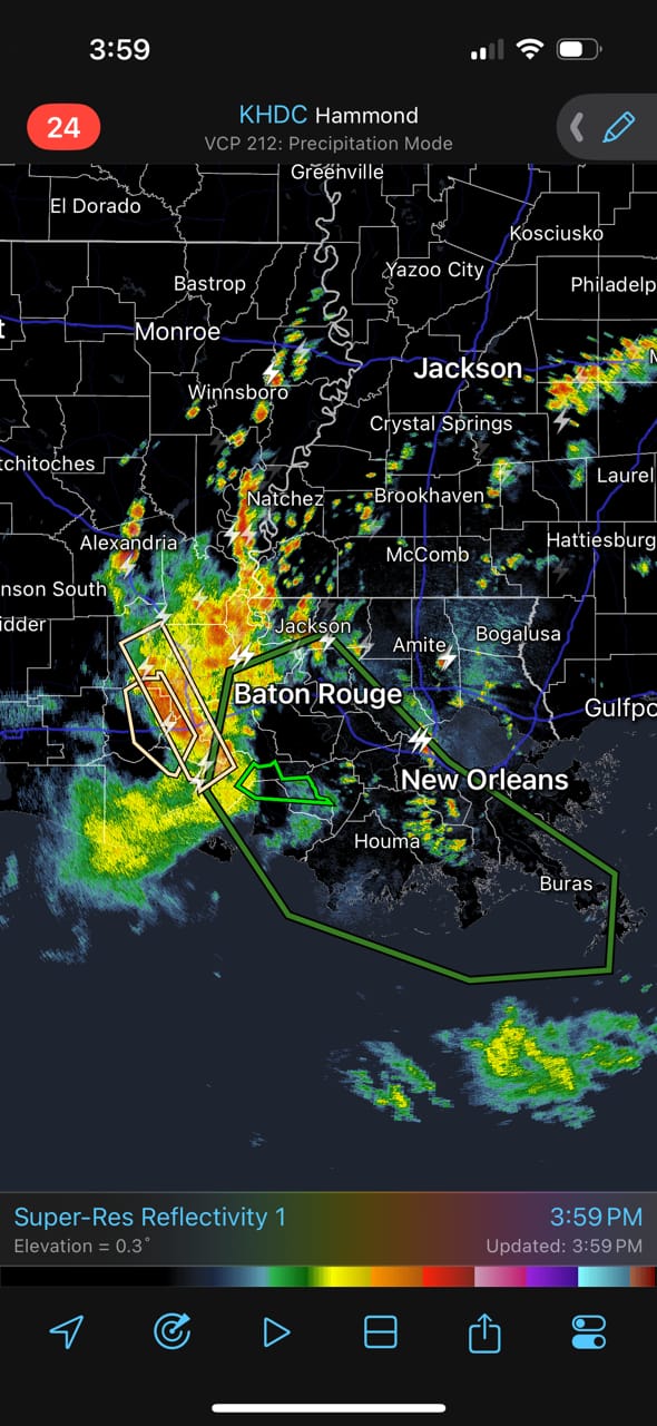
Dismissing the flood threat, rain chances will still be above normal for the next two days, then enter a dry spell through mid week.
Looking for unbiased, fact-based news? Join 1440 today.
Join over 4 million Americans who start their day with 1440 – your daily digest for unbiased, fact-centric news. From politics to sports, we cover it all by analyzing over 100 sources. Our concise, 5-minute read lands in your inbox each morning at no cost. Experience news without the noise; let 1440 help you make up your own mind. Sign up now and invite your friends and family to be part of the informed.
AT-A-GLANCE: SLIDELL
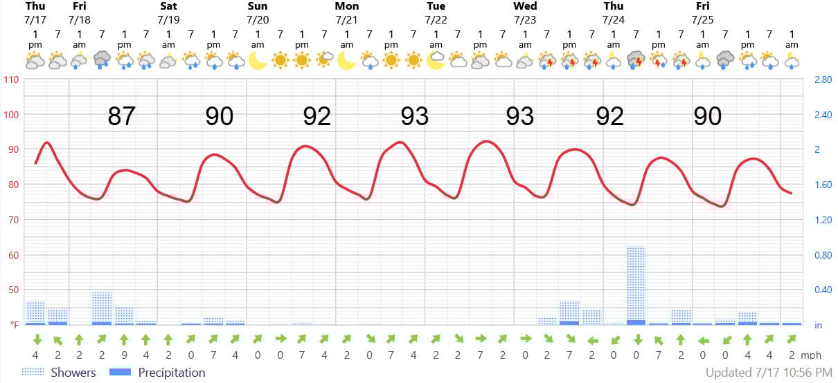
FORECAST DISCUSSION
The Foreca graphic looks fine, except that it usually underestimates the high temperatures. Shower and storm chances for tomorrow afternoon look above average, then come to down to average on Saturday before being marginal (20% or less, mainly withing 20 miles of the Lake and Sound) for Sunday through Tuesday.
The same upper air energy packet that is impacting the Lafayette area today will travel around a high pressure area and impact us from the northeast again next Wednesday - Friday. That will drive shower and thunderstorm chances up again, but am not expecting any tropical storm development .
LONG-RANGE RAMBLINGS
The period July 17-August 5 is very critical in determining the strength of the hurricane season. If Cape Verde storms form or anything forms in the Main Development Region westward from there to the Leeward/Windward Islands, it’s a sign that conditions are ripe for an above average season. It’s a bit like cheating on a test by taking a sneak peak at the first page.
Fingers crossed. Some models are indicating upper level winds will be a bit more favorable in the next few weeks, but none of the models are indicating any development - perhaps because of the Saharan Dust Layer. We could well get through this period with no storms.
The One thing that the long range models are showing is a massive heat wave building over the upper Midwest in another week to 10 days. Though the center is well away from us , we could experience a taste of that heat during the last few days of this month.
ALABAMA & NW FL BEACHES
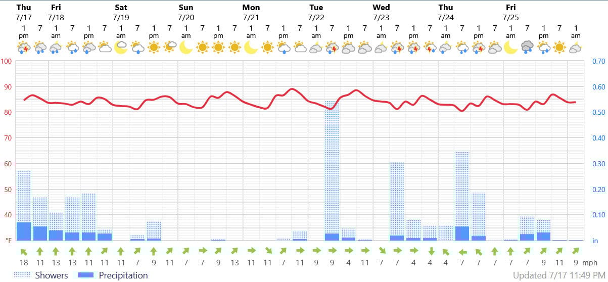
Foreca graphic for Pensacola Beach shows a nice weekend with highs upper 80s to low 90s sandwiched between two wet periods. The next system will move in there on Tuesday, a day earlier than those of us who live in SE LA and Coastal MS.