- Wound Up on Weather
- Posts
- Cold, wet Sunday; Freezing Monday
Cold, wet Sunday; Freezing Monday
David Gilhousen
January 20, 2026

SUMMARY
Yikes! All models point to an epic winter storm this weekend that will define the season for many across the upper South — but not us. Only a cold rain is expected Saturday night and Sunday followed by several nights with temperatures in the 20s.
By epic, I mean catastrophic for places along or just north of I-20 from Dallas to Jackson to Atlanta. Many of these places will experience an ice storm with downed trees, extended power outages, plus road and airport closures. An inch of ice is entirely possible in places like Shreveport, Columbus, MS, and parts of the Atlanta metro. Let me explain.
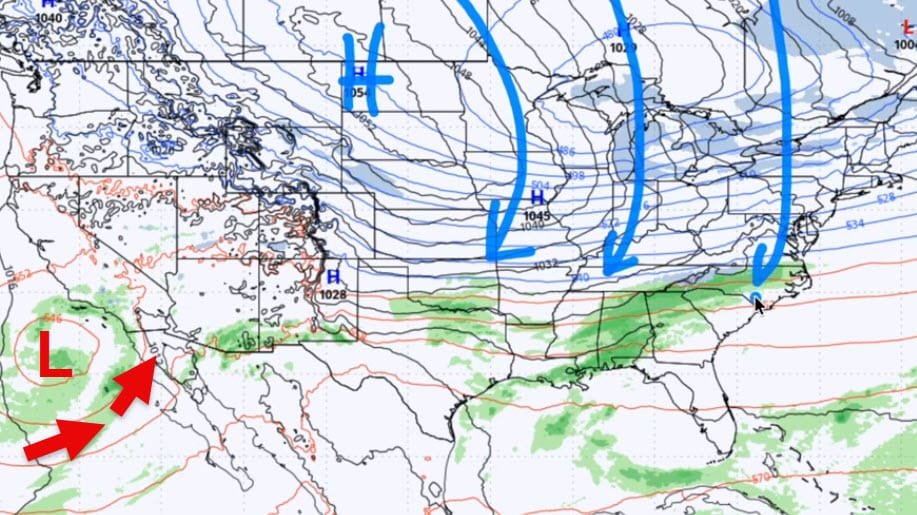
Friday morning’s ECMWF model features a large Canadian High centered over the Dakotas bring Arctic air down to the Upper South ( blue arrows). At the same time, an upper low off Southern California is bringing warm air northward (red arrows) into the Desert SW at mid-levels of the atmosphere. That upper low will move east and cause the warm air to over-ride the cold air by early Saturday in the Plains. That’s a formula for widespread winter precipitation.
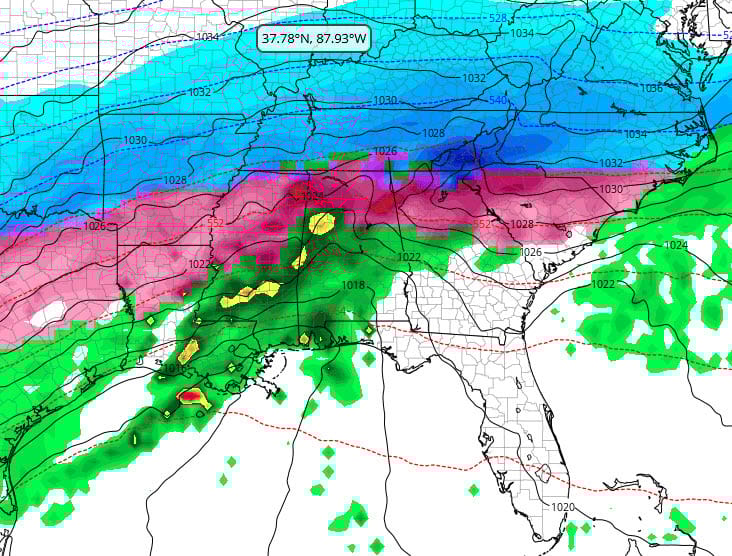
By Saturday night at 9 PM a large swath of precipitation extends from Texas through Virginia. The blue areas to the north show where the model expects snow to take place , the red defines the freezing rain area, and the green simply rain (the tiny red area off the LA coast means a thunderstorm). Of all the areas, the one showing freezing rain is by far the most dangerous. The ECMWF model, which has been the most correct and consistent model in the last week, keeps all frozen precipitation north of us before it ends Sunday afternoon. (Graphic from tropicaltidbits.com)
AT-A-GLANCE: SLIDELL
FORECAST DISCUSSION
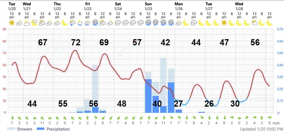
The Foreca graphic looks realistic Enjoy the nice weather tomorrow and Thursday! The front will come through mid-day Friday, capping the highs just at or before they reach 70 and ending the first batch of scattered, light showers Thursday night and Friday morning.
Then, cloudy, cool weather will prevail on Saturday but I’m not expecting more showers until after dark. Then, a cold, dreary 40 degree Sunday is in store with off-and-on showers that could total an inch. It’s a great time to go to church, then stay inside and watch the NFL playoffs. If the games are boring or the zebras show up to ruin the fun, you might find more action on the Weather Channel.
After this weekend, we are in for a long period of sunny weather since this weekend’s storm is a climax event. At first, cold weather will prevail with several nights lows in the mid 20s. Low 20s are entirely possible given this pattern, so watch for an update late this week. The warm up starts on Wednesday.
LONG-RANGE RAMBLINGS
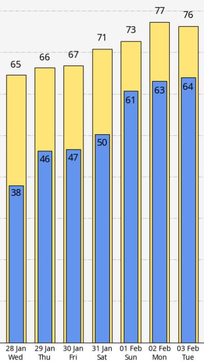
The weather looks to turn lovely after the middle of next week, Wed. Jan. 28. The next chance of showers looks to be Sat. or Sun. Jan. 31 or Feb. 1. Look at these highs and lows forecast by the ECMWF: