- Wound Up on Weather
- Posts
- Early Season Hurricane Outlook
Early Season Hurricane Outlook
David Gilhousen
April 13, 2026

SUMMARY - MY OUTLOOK
Events way out in the Western Pacific are making some aspects of the upcoming hurricane season obvious. However, another more subtle, but key detail won’t be known until next month at the earliest. Let me give my outlook, then explain my reasoning. Here’s what I feel confident about:
1) The total number of Atlantic hurricanes, major ones, and land-falling ones will be below normal…probably less than what the National Hurricane Center and Colorado State indicates.
2) Storms will be especially lacking in the Caribbean and the waters east from there to Africa — the so-called “Main Development Region” (MDR). This means it’s a great year to visit the Caribbean as well as Costa Rica where rainfall will be less than normal.
3) No doubt, quite a number of the storms that form will be “fish storms” in the mid-Atlantic and won’t impact anyone.
4) However, I can’t rule out one or two hurricanes or tropical storms in the Gulf or Atlantic that could threaten the U.S. These would either be home-grown in the Gulf or migrate in from the Atlantic. A June storm in the Western Gulf that would impact Texas looks possible based on the current pattern and European forecasts of May weather.
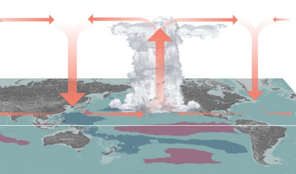
The big driver in this forecast is a strong Pacific El Nino where the warm water in the tropical Pacific shifts to the east side. You can already see this developing using satellite and buoy data and all sorts of models are latching on to a growing El Nino. This puts many thunderstorms in the Eastern Pacific along the equator. Updrafts add a lot of westerly winds to the jet stream level that fan out over the Caribbean and MDR. Since low level winds there are easterly, that means wind shear tearing off the tops of any thunderstorms that develop greatly reducing the chances of hurricane development. It also creates sinking air over the tropical Atlantic which also leads to less rainfall.
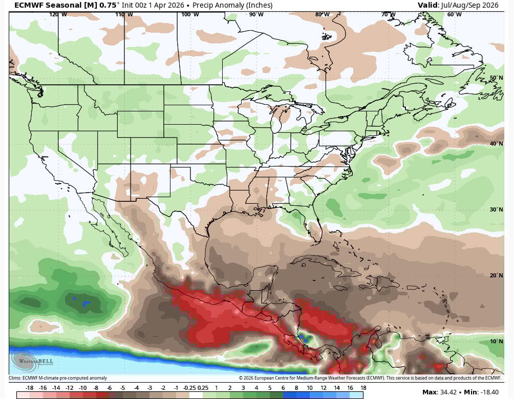
This is seen in this ECMWF seasonal model showing precipitation anomalies (departures from average) for July, August, and September. Notice the dry brown and red colors over the Caribbean signifying less rainfall than normal which agrees with the El Nino thinking. Yet, further north near Bermuda (east of the Carolinas) the color turns green for above normal rainfall. That’s where I expect to see most of the storms this year - where the sea surface temperatures are above normal and the wind shear below normal. But, you say, what about all that brown in the Gulf and over us. Though it may be a summer with below normal precipitation, I’m not sure that I can downplay the odds of a hurricane here for one reason….
What we don’t know yet: the position and strength of the Bermuda High. This will drive where the storms develop north of the MDR. A weak Bermuda High located closer to the Azores than Bermuda coupled with NW wind flow aloft over the Eastern US would reduce the chance of storms hitting the U.S including the Gulf. We just don’t know this yet and past experience has said this is difficult to forecast until sometime in May. And, it could just be a year where there is no clear tendency and the few storms that develop scatter like buckshot everywhere from the Northern Gulf to the SE Coast, Bermuda and beyond. Let’s hope not. We’ll take a look at this again in May.