- Wound Up on Weather
- Posts
- Frost on the pumpkin next Tuesday
Frost on the pumpkin next Tuesday
David Gilhousen
November 04, 2025

SUMMARY
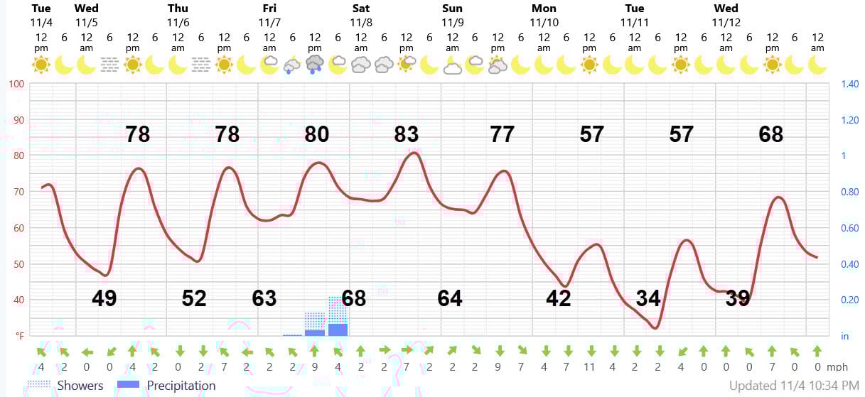
If the trick or treat monsters didn’t smush yours, you should see frost on your pumpkin next Tuesday morning. Widespread low- to mid-30s should prevail from Hammond to Gulfport. But don’t expect cool weather until then. A quick look at Foreca’s weather-at-a-glance graphic shows the roller coaster ride I mentioned in Sunday’s letter. Right now, we’re climbing the hill and will be until Saturday evening when highs should hit the mid-80s!. Then, the front comes through on Sunday , the winds pick up Sunday night and the bottom drops out. Whee…..
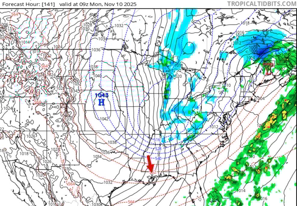
For a somewhat more scientific explanation, another big dip in the jet will develop over the Central and Eastern U.S. beginning this weekend. This will cause a surface low pressure system to develop near Chicago and track east to Maine dragging a strong cold front through. Monday morning’s ECMWF (European) model forecast shows that Low near Maine, a cold front extending into Florida, and a strong Canadian High over Nebraska heading our way. The red arrow shows the strong northerly winds we’ll be experiencing. Those winds will blow the cold air in, but keep us from having frost Monday morning. But as the winds die off Monday night, the frost will settle in. By the way — the blue you see here and there in Tennessee represents snow flurries is possible over the higher terrain there.
AT-A-GLANCE: SLIDELL
FORECAST DISCUSSION
Tuesday and Wednesday should be wonderful with brilliant sunshine. The only problem could be some spotty early morning fog. Friday will feature a few more clouds (and maybe a better chance of early morning fog) with a bit more humidity. Scattered showers with maybe a clap of thunder will develop in the early afternoon hours before dying off at sunset. That’s good news for the prep. football games. Amounts should be light, a tenth of an inch?
Saturday should feature a mix of clouds and sun with highs approaching or reaching the mid 80s. Sunday morning pre-dawn could see a brief, very light shower (not shown in the graphic) as the first wave of cooler air moves into the area. Sunday should see a mix of sun and clouds with the highs still reaching the mid 70s, By late afternoon, the winds pick up and temperatures start dropping like a rock.
Monday will be back to sweaters and jackets weather with windy conditions. Morning lows low 40s and highs mid 50s. Tuesday’s frost should be widespread. Though the cold snap will bring in temperatures well below normal, the cold air will be short-lived. Wednesday’s highs will reach the upper 60s.
LONG-RANGE RAMBLINGS
Date(s) Low High Weather
Thurs 11/13 53 72 Foggy AM (?), then Sunny
Friday 11/14 56 73 Partly Sunny
Sat. 11/15 61 74 Partly Cloudy - Chance Showers
Sun. 11/16 68 75 Cloudy, Humid, Showers
Mon. 11/17 68 75 Thunderstorms, Severe Wx. in MS Valley?
Tues-Thurs. 50 70 Fair, cool, Pacific air
Early December outlook
Expect cold air to get hung up trying to get here most of the time. That means stalled fronts and rainy weather with average temperatures, except for, perhaps, one stellar cold air outbreak. Why the exception?
There’s a correlation between late season hurricanes and an early winter polar air outbreak in the Central and Eastern U.S. The same Madden Julian upper atmospheric wave that leads to favorable conditions for hurricanes off the East Coast or Western Caribbean circles around the globe and gets into a position about 40 days later that would promote cold air coming south. It’s not a perfect relationship, but one that’s observed most of the time.