- Wound Up on Weather
- Posts
- Mid-summer rerun
Mid-summer rerun
David Gilhousen
July 22, 2025

SUMMARY
There will be one more stiflingly hot and humid day tomorrow with highs in the upper 90s and enough humidity to make it feel like 115-120 degrees. The only relief might be a few mid afternoon showers that pop-up in Harrison and Hancock Counties plus the Slidell area. Then, last week’s deja-vu disturbance will move through again with widespread storms for Thursday and Friday lowering the temperatures to closer to 90.
Development is unlikely for this wave of low pressure, even though it will track further south than last time, because of the drier air at 10,000 over the continent that would get sucked into it if it tries to develop.
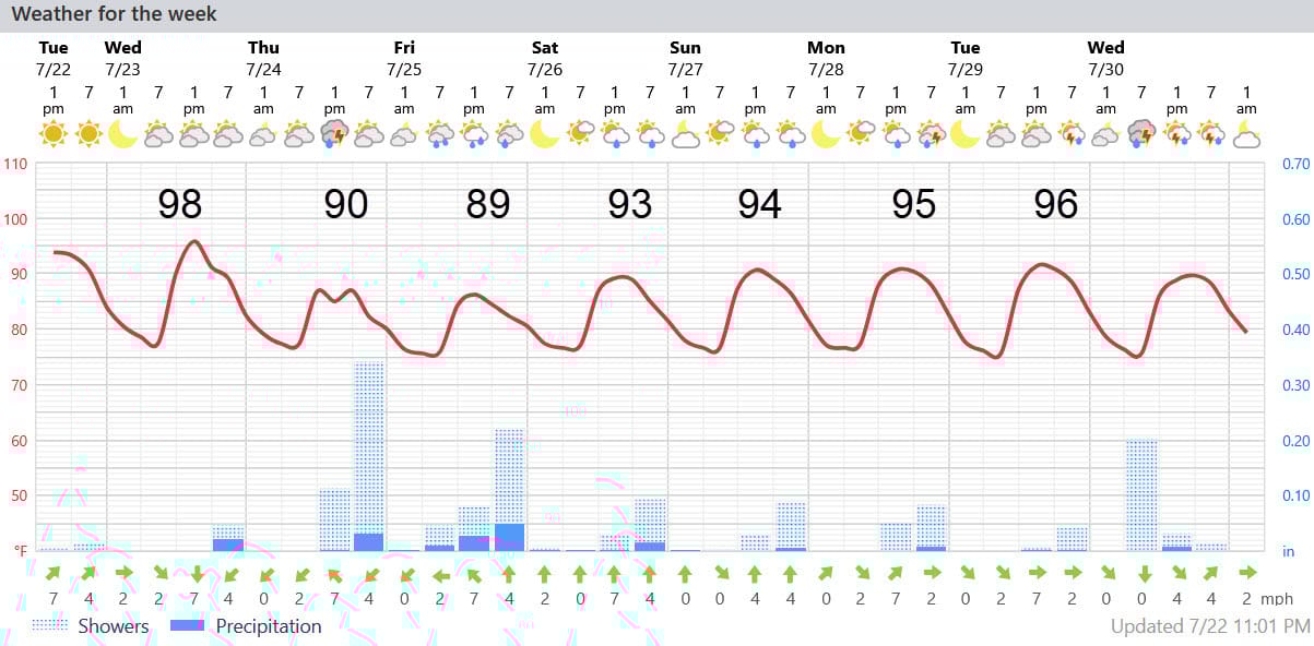
AT-A-GLANCE: SLIDELL
FORECAST DISCUSSION
The Foreca graphic shows the big drop off in temperature for Thusday and Friday followed by a warm up into the mid 90s. The I-10/12 corridor from Hammond to Slidell to Biloxi plus the Southshore could get an inch to an inch and a half of needed rain from this on Thur. and Friday with lesser amounts in inland locations. Showers and storms could extend into the evening and overnight hours as well on Thursday and Friday, especially near the Lake and Sound.
I say needed because almost everyone on the Northshore and Coastal MS is running at 70-80% of normal rainfall for the last month. Amounts after Friday should be modest with more typical widely scattered afternoon showers.
LONG-RANGE RAMBLINGS
Looks like another uptick in rain chances for next Thursday and Friday as well to greet the first of August. None of the models are showing any development in the tropics for the next 10 days. Fingers crossed. It’s a long way until meteorological half-time (Sept. 11).
ALABAMA & NW FL BEACHES
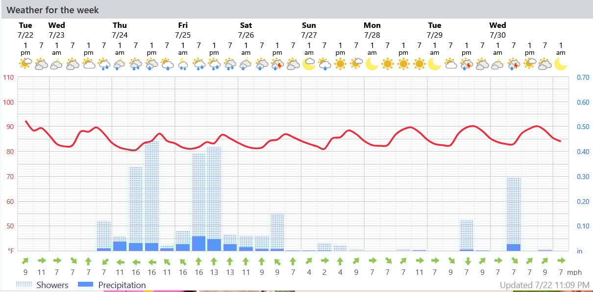
Foreca graphic for Pensacola Beach shows a few really wet days holding the highs down into the upper 80s then a few day break.