- Wound Up on Weather
- Posts
- Showers through Saturday, then HOT
Showers through Saturday, then HOT
David Gilhousen
July 24, 2025

SUMMARY
We seem to be stuck in a pattern where Wednesdays through Friday-Saturday features storms and reasonable temperatures while early week gets blazing hot. Blame it on easterly waves, or waves moving from east to west across the Gulf of Mexico at weekly intervals.
There are early signs that we’ll have a tropical depression and then storm form in the Atlantic anytime from Wednesday through the following Monday. This could threaten Florida or the East Coast in early August. Details in the Long-Range Ramblings section.
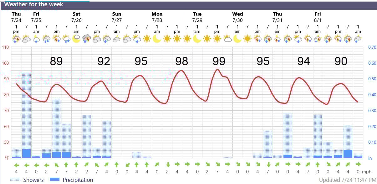
AT-A-GLANCE: SLIDELL
FORECAST DISCUSSION
The Foreca graphic captures the feast/famine or steam/sizzle cycle nicely. Above normal shower and storm chances will keep highs near 90 for the next few days, but it will feel steamy. Though most amounts will be about 0.25” each day, a few could get an inch.
Then, Saturday is transitional day with less showers before the sizzling heat wave reappears. 98 and 99 actual temperatures with real-feel temperatures will into the upper 110s will be common Monday and Tuesday. Get your shopping done this weekend or early in the morning then hibernate in front of your AC. Finally, it’s rinse and repeat for next Wednesday through the following weekend.
In case you are wondering about differences within the Northshore or Southshore - I don’t have a lot of wisdom. Showers and storms start in the late morning near the Lake/Sound and Southshore and either move or redevelop inland later in the day. Some locations 40 miles inland have been getting rainfall only one day a week with lower amounts.
LONG-RANGE RAMBLINGS
Both the European model and its AI partner are showing a strong wave or depression in the Main Development Region half way between Africa and the Windward/Leeward chain by Wednesday. Presently this wave is showing up in European satellite imagery as a strong line of thunderstorms crossing the middle of Africa between Southern Libya and Northern Nigeria.
Both European models move this to a position roughly north of the Dominican Republic and east of South Florida a week from Tuesday (see graphic where arrow shows rough track). Upper level winds are favorable for development in this area.
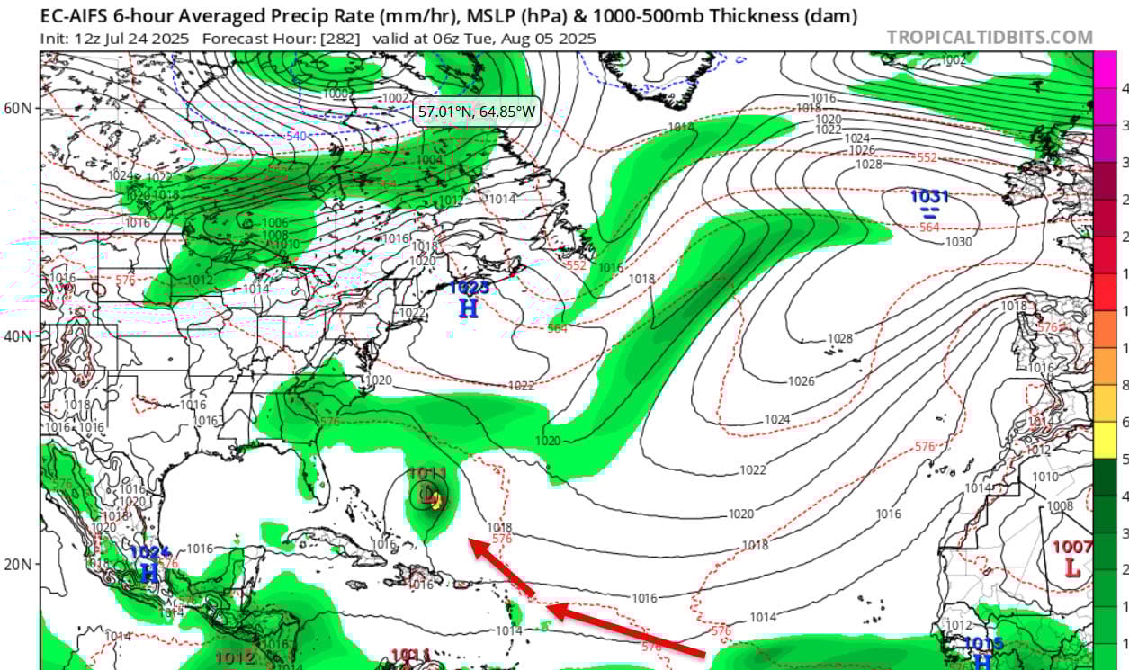
Keep in mind that this is a very long range projection that could miss. However, there has been some run-to-run consistency plus other favorable factors so I thought I’d share this; it appears that the tropics are waking up.
ALABAMA & NW FL BEACHES
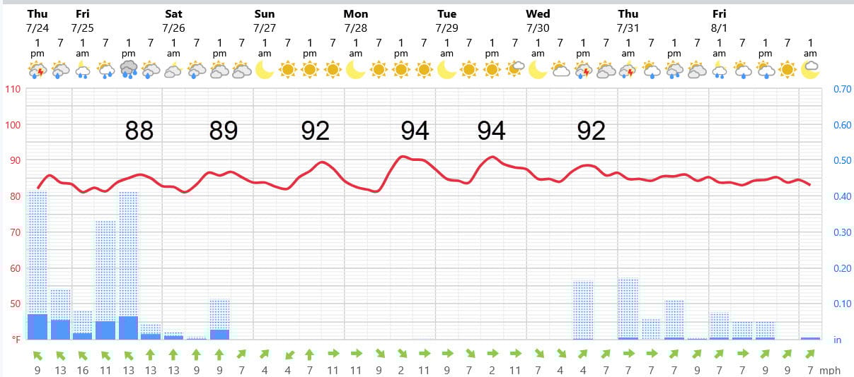
Foreca graphic for Pensacola Beach shows the same cycle as the one in Slidell, Keep in mind that these are beach temperatures - expect upper 90s as soon as you go inland a few blocks.