- Wound Up on Weather
- Posts
- Timing Tropical Trouble
Timing Tropical Trouble
David Gilhousen
July 27, 2025

SUMMARY
The more important news concerns the tropics, where we anticipate our first wave coming out of the Main Development Region late this week. There’s a chance this could develop next weekend and threaten the U.S. the following week. Also, my long-range guru is forecasting which weeks he thinks will see a greater chance for tropical storms and hurricanes. Believe it or not, there’s a scientific basis for that and I’ll explain both of these developments in my “Long Range Ramblings” section.
Back on the home front, tomorrow and Tuesday will be sizzlers with almost no showers or storms on Monday. Then, storms will return to many of us by late Tuesday, and everybody by Wednesday. The wet spell will last through Friday.
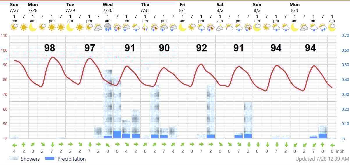
AT-A-GLANCE: SLIDELL
FORECAST DISCUSSION
The Foreca graphic give you right idea with Monday and Tuesday in the upper 90’s, then rainfall keeps the temperatures down through Friday or Saturday. Storms should approach us from the northeast Tuesday afternoon spreading rain across Coastal Mississippi and into Eastern St. Tammany. The storms may peter out by sunset, and then reform overnight moving through the rest of the North and South-shores.
Then, Wednesday and Thursday look wet with above average showers and storms with more reasonable high temperatures near 90, but with that sauna-like humidity. Friday and Saturday look to transition out of the heaviest rainfall with more localized mainly afternoon storms. The, the latest European model (not fully reflected in the Foreca graphic) shows another dry and hot Sunday. It’s an all-too familiar cycle.
And what could break that cycle….some tropical development, perhaps? (Boy, I sure hope not, but read on)
LONG-RANGE RAMBLINGS
A wave will move through the Main Development Region this weekend without showing much signs of development until it emerges north of the Virgin Islands by Friday. Both the European and the European AI model (shown below) depict a wave north of the Dominican Republic next Sunday. The green and blues show the precipitation on the back side of the system.
It’s at this point that models differ. The European never develops this, moves the tropical moisture towards the north and the moves it out to sea with the westerlies. The AI moves it towards South Florida while developing it into a tropical storm.
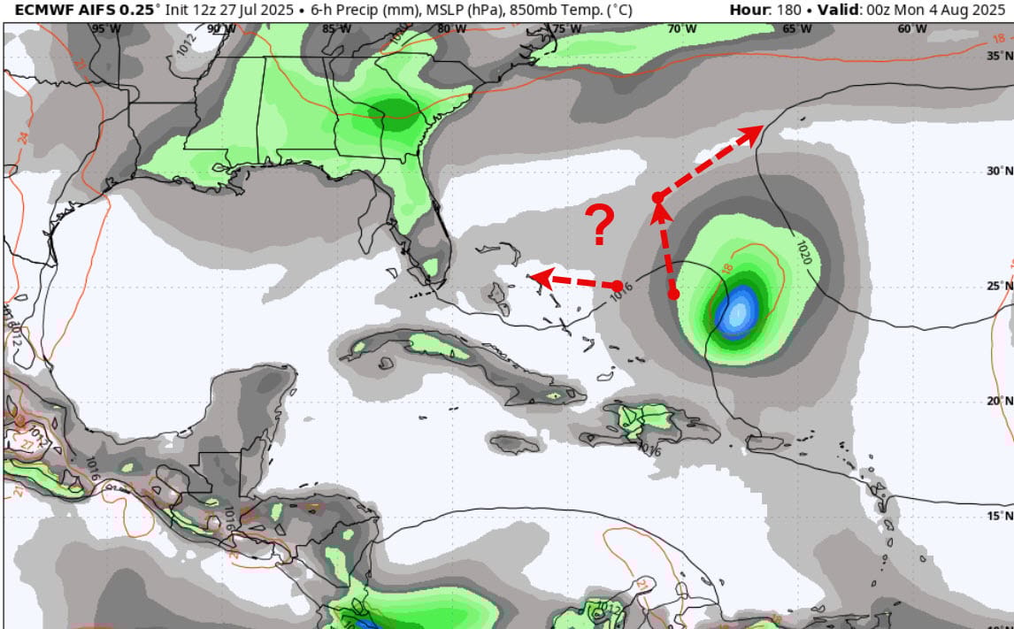
Though it’s way too early to get any sense of whether this poses a legitimate threat to the U.S., the further this wave travels west, the more likely it is to develop because upper air conditions will become more favorable the closer it gets to Florida and the Gulf. Why’s that? It’s because of a giant upper atmospheric wave called the Madden-Julian oscillation that slowly travels over the tropics circling the earth about every six weeks.
When certain parts of the wave move through, the Caribbean, Gulf, and Western Atlantic are more likely to see tropical storms and hurricanes develop because upward motion is favored. In others phases, activity is suppressed with sinking motion. Enough of the meteorology lesson.
The favorable phases for tropical development will likely happen from August 8-24. Unfavorable times are from August 25 through mid-September, with activity probably picking up again for late September and early October. The nice aspect of that is that we should be in an unfavorable phase for the peak of the season, Sept. 11, when other factors are at their peak.
By the way, I had a chance to work with Dr. Paul Julian, a fellow Penn Stater, in the 1980s where I benefited from his tutelage.
ALABAMA & NW FL BEACHES
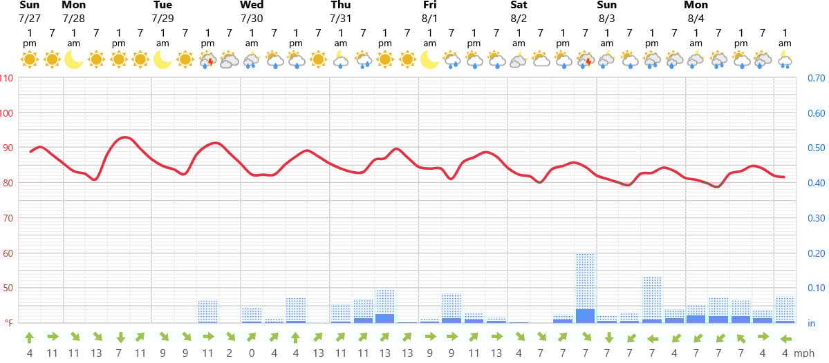
Foreca graphic for Pensacola Beach shows mid 90 degree weather for the next few days fading into a deep tropical moisture regime where showers could occur almost anytime and highs in the upper 80s. Pretty skies, good for a quick jaunt to the pool between showers, but not the best beach weather.