- Wound Up on Weather
- Posts
- Too much weather for one title!
Too much weather for one title!
David Gilhousen
October 21, 2025

SUMMARY
Wow! There’s a lot to talk about as we enter a period when the seasons flip.
First, there’s an enhancing shot of cool air which will cause the low humidity, good feel air to continue through this week.
Next up is some return flow from the Gulf and an upper air feature that will give us a line or two of showers and thunderstorms early Sunday. It’s still over four days away, but odds look good that many of us will see an inch of rain, or close to it.
Third, a couple of warm, more clouds than sun days on Monday and Tuesday before the Big Kahuna Cold Front arrives courtesy of a dip in the jet stream. My long-range ramblings section will discuss this as well as….
The tropics. Tropical Storm Melissa has formed in the Central Caribbean closer to Venezuela and Aruba than anywhere else. Though this will NOT be our storm in the Northern Gulf, it will likely have serious impacts to islands such as Cuba, Jamaica, and possibly Haiti (Hispaniola) I’ll discuss the possibilities of where this could go.
AT-A-GLANCE: SLIDELL
FORECAST DISCUSSION
At times like these, I wish I could make my own graphic like Foreca’s, but I gave up writing software when recent grads. laughed at my code. One big problem with this graphic: They emphasize next Wednesday’s rain over this weekends when recent model’s show it’s the other way around.
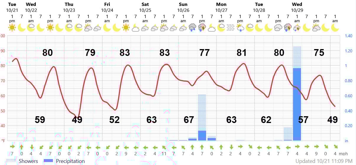
Tonight will be fairly similar to last night with lows near 60, mid-upper 60’s Southshore. Then, tomorrow will seem a bit less hot and humid with highs near 80. Thursday morning’s low will slip into the upper 40s in many rural and suburban Northshore and S. Mississippi locations. Again, not much change in the lows on the Southshore. Friday and Saturday will be warmer and humidity will start to creep back in Saturday afternoon.
Clouds should increase late Saturday afternoon with a chance of showers moving in by midnight, especially in Western St. Tammany. Sunday morning will feature one or two lines of showers and storms that will give many of us an inch of rain. Much needed. Timing looks to be between 4-10 AM. Skies should show some breaks by afternoon.
Monday and Tuesday will not be any cooler with skies that feature more clouds than sun. Highs about 80, lows low 60s. This should be the last 80 we see for a few weeks.
Then, the big cold front we’ve all been waiting for arrives with a brief shower or thunderstorm late Tuesday night or early next Wednesday. Highs on Wednesday will stay in the mid 70s with wind.
LONG-RANGE RAMBLINGS
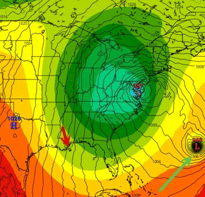
The cold air will be caused a big dip in the jet as shown by this ECMWF forecast of upper air winds (colored contours) and surface features (solid thin lines are surface pressure) valid next Thursday at noon. A big upper air low looking like an egg is centered over West Virginia giving us NW flow aloft and the surface pressure pattern indicates strong northerly wind (red arrow) at the surface. All models are in good agreement on this slow moving feature.
So what does this mean? Next Thursday Oct. 29. Lows near 50, Highs low to mid 60s but with plenty of wind making it feel cooler. Southshore lows may be 10 degrees warmer, but with even more wind. That’s sweater and light jacket weather.
Friday Oct. 30, Sunny. Winds die off, esp. on the Northshore. Lows mid 40s North. Highs near 70.. Perfect for the kiddos….
Long-range tendencies indicate the cool weather to continue into early November with several days during the first week showing highs in 60s, lows in low to mid 40s.
On to the tropics….Tropical Storm Melissa formed early today within a few hundred miles of Aruba. I was watching a webcam last night of lightning well out to sea north of my favorite snorkeling island, Bonaire. It was an amazing light show, and I knew that all that upward motion meant that Melissa was being hatched. The 5-day NHC forecast for Melissa is shown below.

It’s obvious that Melissa will be a slow mover, but there’s a lot of uncertainty after three days since Melissa is in its early stages of growth and its track depends on how far it grows. One of the islands will see considerable damage from the heavy rain and mudslides, but where the warnings go up depends on the track. My take is that the NHC forecast moves it too far to the north and east too quickly after three days.
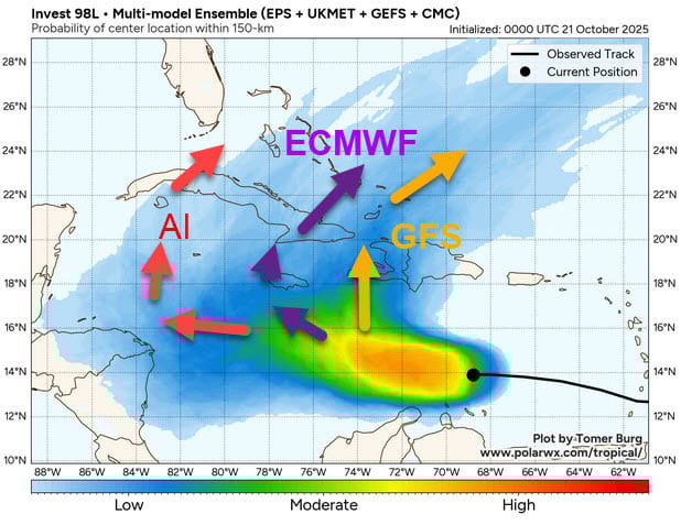
The last graphic shows the spread of where models are taking this storm, courtesy of polarwx.com. The first cluster is mostly from the American GFS runs (orange arrow) and its kin which deepen Melissa rapidly and take it over Haiti. I think there’s too much wind shear for Melissa to rapidly deepen in the next few days, so I don’t think this will happen. The ECMWF (purple arrow) meanders Melissa to near Jamaica where it wobbles for a few days, strengthening because of lower wind shear, before getting picked up by that big dip in the jet that I mentioned. You can see where it ends up in ECMWF forecast graphic. Finally, AI models take it due west before getting picked up by the same trough taking it over Central Cuba. All of them avoid taking it into the Keys or South Florida, but we’ll be watching just in case. Odds certainly seem to favor Jamaica and/or Cuba at this point.
A reminder: These storms do not have a mind of their own. They are steered by winds aloft and with a big dip coming in the jet — features which are well forecast by models— there’s no way this will impact the Northern Gulf.