- Wound Up on Weather
- Posts
- Wet Friday, Lovely Saturday & Sunday
Wet Friday, Lovely Saturday & Sunday
David Gilhousen
April 30, 2026

SUMMARY
Large north-south differences in rainfall last night across the Northshore: One example, the north side of Picayune had over 2”, at my house in Slidell only 0.16”. As expected, the storms died as they went south. Friday should see more widespread totals of a 0.75” or greater…and the long-range outlook calls for a wet first two weeks of May.
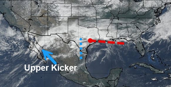
This afternoon’s satellite image shows why. The front that brought us last night’s rain is east-west, parallel and just inland from the Louisiana coast south of New Orleans. An area of thunderstorms is breaking out in and around Baton Rouge (scroll down to see radar) and is gliding east just north of the front, which is shown by a dashed red line. That front is sagging very slowly south. In central Texas, a low pressure area forming on the front with an associated cold frontal like trough labeled by a blue dashed line. It is slowly moving east. An upper level trough over Baja California is moving at a faster pace eastward and will serve as kicker to strengthen the Texas low and move it in our direction.
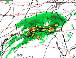
As the low approaches us, we’ll see widespread showers tomorrow afternoon with embedded heavy thunderstorms coming in during the evening hours, say about 8 PM. This ECMWF forecast shows the rainfall between 10 PM and 1 AM Saturday with the yellows and reds indicating the storms. You can see why I’m calling for widespread totals approaching an inch. The good news is that it should all be over well before daybreak with clearing skies during the morning hours. Those who don’t want to rush into summer will be delighted with highs only in the 70s and lows in the 40s and 50s with low humidity.
AT-A-GLANCE: SLIDELL
FORECAST DISCUSSION
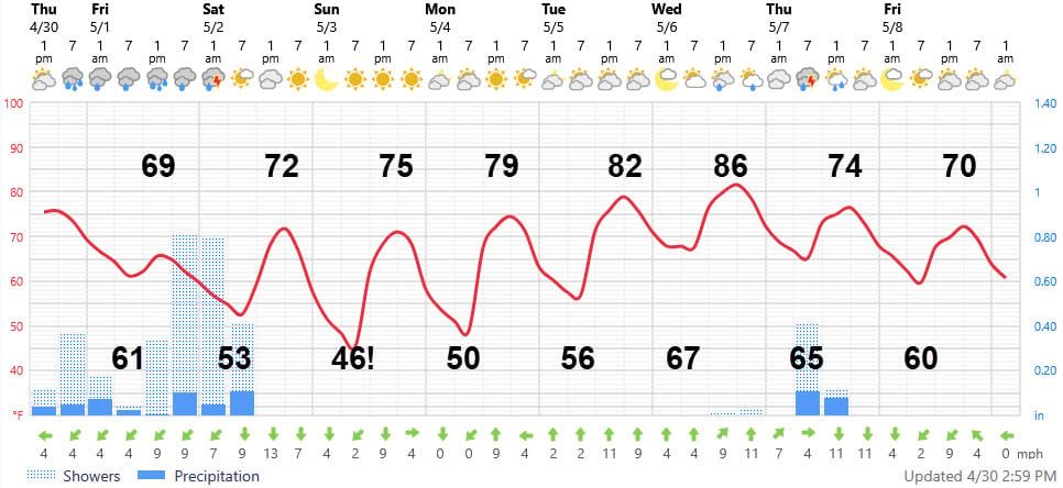
The Foreca graphic captures the big picture with the temperatures, though is too cold with some of the highs during sunny days. The forecast low of 46 for Sunday morning is amazingly cold for early May (mid 50s Southshore). After the warm up on Tuesday, the winds swing around to the south and bring the humidity and low temperatures back up ahead of yet another cold front on Thursday morning.
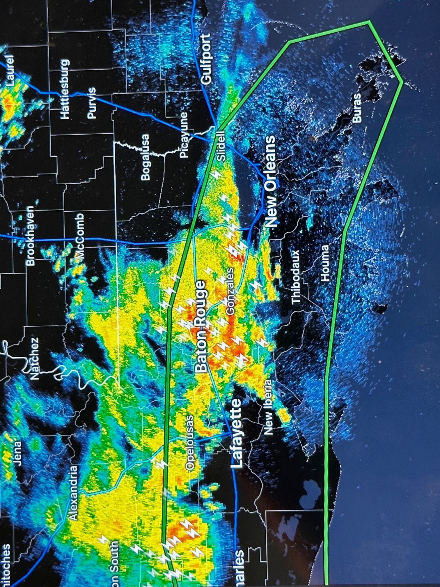
Concerning rainfall, storms are breaking out in the Baton Rouge area now are heading east and could give us a half inch or more tonight, mainly on the Northshore. Showers should break tomorrow morning before increasing in the afternoon as mentioned earlier. Showers should end before daybreak on Saturday. Next rain chance with the next cold front next Thursday AM.
LONG-RANGE RAMBLINGS
Next Saturday May 9 looks wet and cool — the cold front will hang up again just off the coast and another wave will ride along it. Temperatures mainly in the 60s to low 70s. Sunday May 10, if the skies clear in time,it could be another gem - highs mid to upper 70s, lows low 50s Northshore. Expect several more shower chances before we get to mid May — all told I can see 2-4” of rain for many of us before mid-May. After that, models turn it hot and dry. We’ll see…..