- Wound Up on Weather
- Posts
- Wet weekend; June TS in Gulf?
Wet weekend; June TS in Gulf?
David Gilhousen
May 19, 2026

SUMMARY
Showers today were mostly confined to parts of Tangipahoa Parish as the axis of moisture coming up from the Gulf is centered near Baton Rouge. Tomorrow should change that as the axis moves in our direction, say from Bogalusa-Covington-River Parishes line by mid-afternoon. These areas, and places to NW of it, will certainly get in on the showers. Showers will probably make it into the Picayune-Slidell-New Orleans area before petering out leaving the MS Gulf Coast dry.
Thursday, the axis will move eastward giving just about everyone a good chance of showers and storms, which could break out by late in the morning except for ….the MS Gulf Coast which should see something by late in the day.
Friday looks wet everywhere with showers and storms almost anytime, even the MS Gulf Coast. Several inches are possible with these. Just about everyone should get in on rain on Saturday as well, but it could be more confined to an hour or so in the afternoon.
Sunday, the moisture axis moves a bit to the west. Still, showers and storms seem likely for everyone except the MS Gulf Coast. The greatest chance will be back in Western St. Tammany. If the pattern holds, Memorial Day looks wet, too, though the European model goes considerably drier bucking the model consensus. Here, I’ll defer to the consensus especially when the overall flow is stuck.
To summarize….much more rainfall, perhaps 4+ “ totals in parts of Western St. Tammany, Tangipahoa and the River Parishes than further east. Showers will be spread out over more days in the West, as well. Biloxi might get just a half inch to an inch.
AT-A-GLANCE: SLIDELL
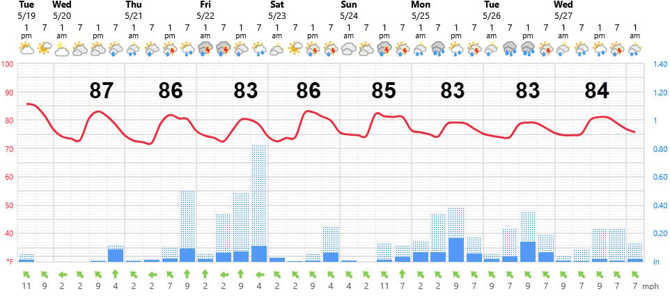
FORECAST DISCUSSION
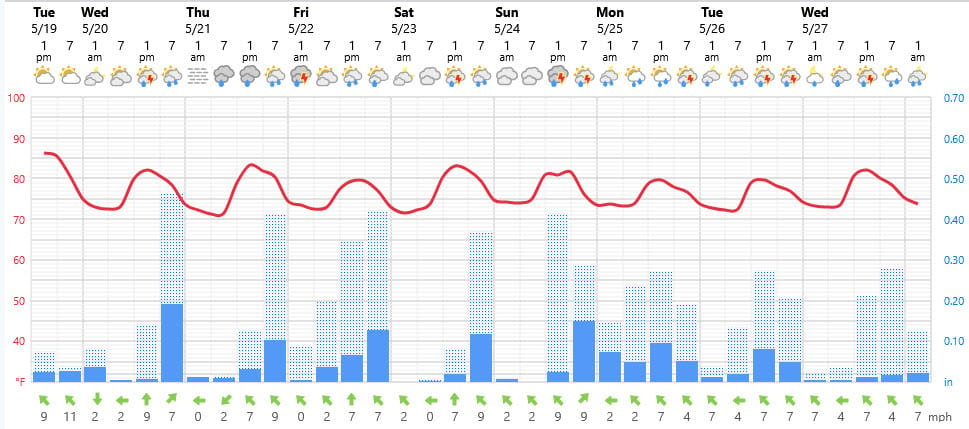
The Foreca graphic does a nice job with this complicated situation, but remember that the precipitation will look really different going from west to east. For example, here’s the graphic for Hammond, LA. Even though the vertical axis is not same (wish I could control that), the showers and storms are spread out through the next 8 days.
LONG-RANGE RAMBLINGS
Models are showing less precipitation next Wed. and Thursday — more like the typical scattered afternoon showers than deluges. Highs will be in the mid-upper 80s. In fact, the current modeling dries the atmosphere and warms it by the weekend of May 29-31. Perhaps that will feature our first 90 degree day.
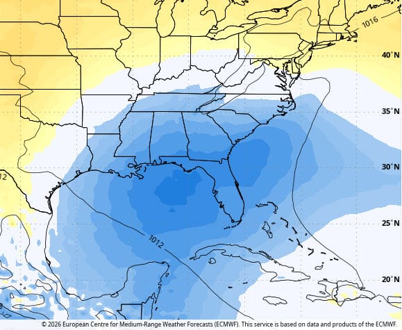
The long-range European model is advertising a development in the Gulf. This forecast map shows anomalously low pressures (blues) in the NE Gulf for a seven day period centered around June 6. Tropical upper air patterns favor this, too. We’ll see… Remember there is no relationship between a tropical storm in the Gulf in June and an active season when August and September roll around. In fact, with the coming strong El Nino, developments are favored more in early season than in mid-season.
ALABAMA & NW FL BEACHES
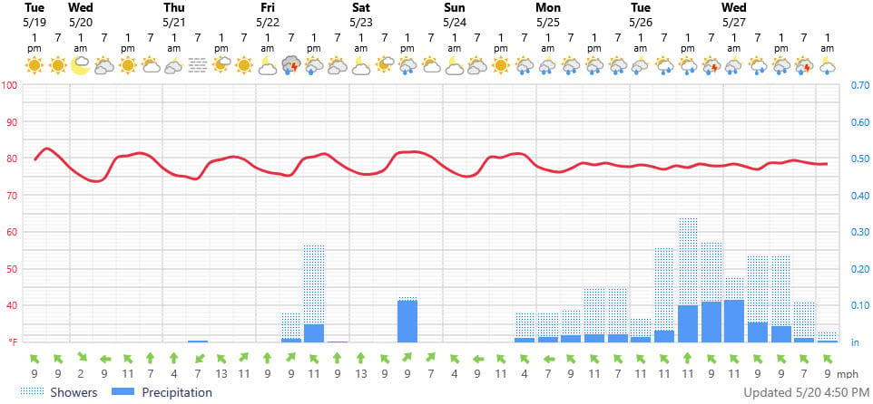
Foreca graphic for Pensacola Beach shows somewhat better weather than in Louisiana. A brief shower or storm is possible Friday and Saturday. but Sunday looks fine until sunset.
Further east, the forecast is even better with more sun, warmer temperatures, and precipitation holding off until Monday at Panama City Beach..
